Manifesto (3): The Map
I wanted to draw a map of our kingdom and I always like to draw maps, especially imaginary ones when I was in secondary school! It was interesting to plan the map to be spider-shaped. We decided that our kingdom would be an island cut off from the external world.

Rough drafts of the map.


According to my amateurish map-drawing experience, the small bits and details are hard to fake. That is why I search for little snippets of the edges of Hong Kong Island and added them to our map. It was really fun to incorporate the real with the imaginary in order to make fiction more believable.


We also each drew the territory of our own being so the map is a collaborative exercise. For example, Dumpees live in sunflower fields and Cotton-tailed have their textile-manufacturing factories.

Photo taken when the map is put on the wall, edited.
Rebels
We had an idea since the beginning that the Queen's map would be drawn over with the Rebel's plan of how to take down the Queen. I tried to initiate a mock "Rebel group meeting" of how we should take down the queen, but it was quite hard to come up with ideas. Katie suggested researching war tactics, which was really helpful because none of us actually knew how war strategies and mapping worked.

Looking into old maps with markings of troop placements and barricades.
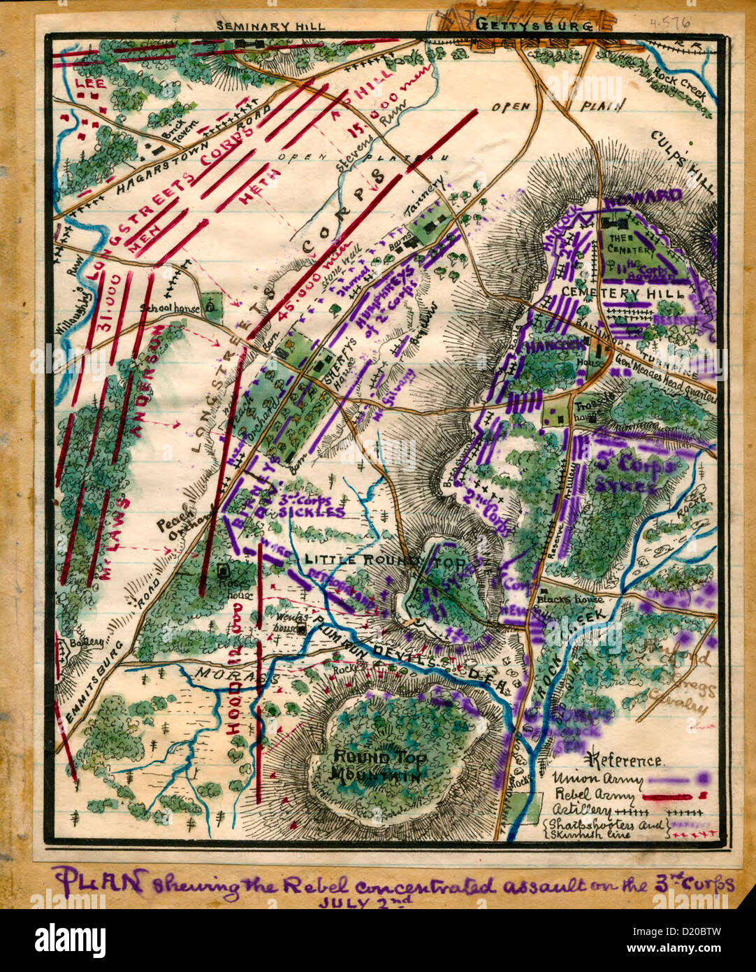
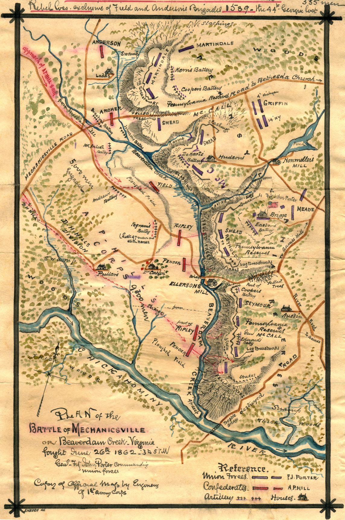

More links about sieging and war plans:
http://articles.latimes.com/1991-02-28/news/mn-2834_1_war-plan
https://en.wikipedia.org/wiki/List_of_military_strategies_and_concepts
http://medievalcastles.stormthecastle.com/sieging_castles.htm
This gave me a rough idea of how things worked. So I started to plan the conquest.

We also each did different experimentations on the map (stored in the drawer).

To make the map scruffier, we stained the map with a teabag and folded it several times to add some creases, as if it has been used (should have folded it the map way). It is then scanned as A3.

In our tutorial, Irish thought the ancient map did not match the clean style of the official document we were looking for, but she suggested that we can keep and present it as an ancient artefact. She suggested adding a frame and a description, and turning the text into typed text to make it more professional. It definitely presented the map in a more organized way.
I love how we worked the map from a large to small scale, from A2 to A5 and adding bits of texture and markings inbetween. It is a very fun process.
Comments
Post a Comment